Birgitta Trail – Explore the Nature of Lempäälä Overview
Overview
The Birgitta Trail is a circular hiking route of approximately 50 kilometres, located in the scenic lake and forest landscapes of Lempäälä, Finland. The route is named after St Birgit Church, a 500-year-old landmark and one of the most famous historical sites in Lempäälä.
View the Birgitta Trail map (PDF)
Nature and Scenery
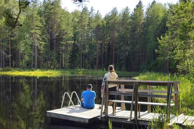
The Birgitta Trail passes through forests, lakeshores, rocky ridges, and open views.You can enjoy peaceful nature, wildlife, and varying terrain — from soft forest paths to duckboards over wetlands.
- Ideal for both short walks and longer hikes
- Marked with yellow signs and trail markers
- Dogs are welcome, but must be kept on a leash
- No winter maintenance (some sections become ski tracks in winter)
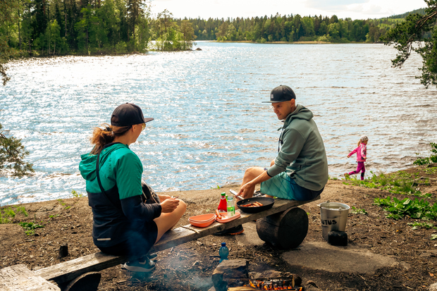
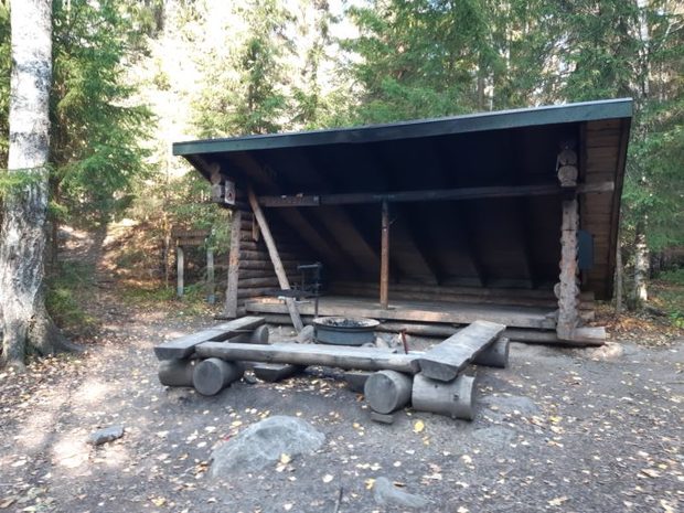
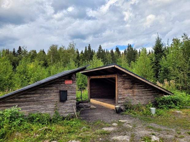
Facilities Along the Trail
The route includes numerous rest areas and services for hikers:
- Campfire and picnic sites
- Lean-tos and huts for overnight stays
- Firewood shelters
- Dry toilets (outhouses)
Please use only official campfire sites and follow local fire safety rules.
During forest fire warnings, all fires are prohibited.
Keep nature clean — take your litter with you.
Arrival and Access Points
The trail passes near residential areas, making it easy to reach by bus, train, or car.
Popular starting points and parking areas include:
- Hakkari Sports Centre – Kapteenienkatu 5
- Hääkivi Rest Area – Turuntie 128
- Sääksjärvi – Sääksjärventie 2
- Kirskaanniemi – Koipitaipaleentie 19, 100, 148
- Vähä-Riutta – Savontie 654
- Vähä-Kausjärvi – Haapalammintie 350
- Saarikonmäki Shelter – Heposuontie 117 (requires gate key)
Addresses are approximate and based on Google Maps.
Public Transport
Birgitta Trail can also be reached by Nysse local buses:
- Sääksjärvi area: Lines 55, 60, 52A, 50, 60
- Kirskaanniemi: Bus 5 (Vuores – Mäyränmäenkatu stop, about 3 km walk)
- Hakkari and Hääkivi: Buses from Lempäälä centre
- Train: Lempäälä Railway Station ≈ 1.5 km from Hääkivi Rest Area
Check schedules at Nysse Journey Planner
Fire Safety and Responsible Hiking
- Make fires only at official campfire sites.
- Do not create your own fire pits.
- Respect fire warnings issued by the Finnish Meteorological Institute.
- Follow the Outdoor Etiquette – enjoy nature responsibly and leave no trace.
Read more about Outdoor Etiquette (Luontoon.fi/en)
Check fire warnings (Finnish Meteorological Institute)
Trail Map
You can get a printed Birgitta Trail map at:
- Lempäälä Service Point at Lempäälä House (the municipal office) – Manttaalitie 15
- Ideapark Shopping Centre – Ideaparkinkatu 4
Download the Birgitta Trail map (PDF)
Featured Rest Areas
Kirskaanniemi
One of the most popular spots on the trail.
- Scenic views from a rocky shore
- Lean-to, hut, campfire sites, tables, benches, and dry toilets
- Firewood available
- Accessible via marked paths from three parking areas.
- Stroller-friendly route available via the maintenance road (red gate, 200 m south of parking).
Vähä-Riutta

A lakeside rest area suitable for visitors with reduced mobility.
- Large hut (15–20 people), indoor/outdoor fire sites, pier, dry toilet
- Nearby Koukkurahka bog and Eevert’s Boulder natural attraction
Saarikonmäki (Accessible Site)
- Lean-to, campfire site, firewood, dry toilet
- Accessible by car via Heposuontie (key required for gate)
- The area features lush hazel groves and peaceful forest surroundings
Gate key available Mon-Fri:
Service Point at Lempäälä House (the municipal office), Manttaalitie 15
Phone: +358 40 133 7300
Please reserve the key by phone before visiting.
Ammejärvi
The Ammejärvi rest stop is located by a peaceful forest lake surrounded by bog moss and pine woods. It is ideal for families and small children. The area includes a lean-to shelter, two campfire sites, and a dry toilet. The route runs through the Sääksjärvi area, where you can stock up on food and supplies before your hike. Along the trail, you can also visit the lush Lehtivuori hill and explore the unique rock formation known as “Hirvi-Simuna’s Cave”.